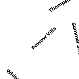
47 THOMPSON ST
Owner Information
MEDRANO JOEL S
47 THOMPSON ST
AMESBURY, MA None


Property Details
47 THOMPSON ST is classified as a Two-Family Residential (Two family).
The primary structure on this property was built in 1895. There are 4,880ft2 of built area within this property. There is 2,184ft2 of residential/living space within this property. This property is listed as having 10 rooms.
47 THOMPSON ST is valued at $420,100. The land is valued at $148,300 and the structures are valued at $263,400. There is an additional valuation of $8,400 on this property.
This property is in Zone R8. Confirm with local Zoning Board authorities to ensure there are no overlays or other easements on this property.
The most recent deed for 47 THOMPSON ST is recorded at the local registrar in Book 38264, Page 62. 47 THOMPSON ST was last sold on Friday, February 14, 2020 for $480,000.
Assessment data from fiscal year 2022.
Flood Data
This property is partially within the AE Zone (within floodplain). Approximately 0.11 acres (46.86%) of the property is within this zone.
This information is sourced from the FEMA National Flood Hazard Layer. See our full disclamer.
Broadband Internet Providers
| Provider | Type | Bandwidth (mbps) | |
|---|---|---|---|
| GCI Communication Corp. | Satellite | 0 | 0 |
| HughesNet | Satellite | 25 | 3 |
| VSAT Systems, LLC. | Satellite | 2 | 1 |
| Viasat Inc | Satellite | 100 | 3 |
| Verizon New England Inc. | DSL | 15 | 1 |
| Comcast | Cable | 1000 | 35 |
| T-Mobile | Fixed Wireless | 25 | 3 |
Broadband service provider data from December 2020.
Adjacent Properties
- 45 THOMPSON ST
Single Family Residential owned by CALDWELL FREDERICKA - 51 THOMPSON ST
Two-Family Residential owned by TRUSTEE OF THE 51 THOMPSON STREET REALTY - 19 GARFIELD ST #B
Residential Condominium owned by PANDOLPH JOSEPH C - 17-19 GARFIELD ST
Other, Open Space owned by MASTER DEED - 17 GARFIELD ST #A
Residential Condominium owned by RAMSDEN BRENDAN P